Heat Map Visualization
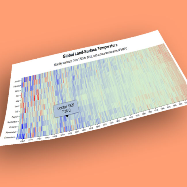
An interactive visualization of global land-surface temperatures since 1753.
©2019 JulianNF | Template by Bootstrapious.com, ported to Hugo by Kishan B, and modified by JulianNF
An interactive visualization of global land-surface temperatures since 1753.
©2019 JulianNF | Template by Bootstrapious.com, ported to Hugo by Kishan B, and modified by JulianNF